Bellingham is the largest city in, and the county seat of Whatcom County, Washington, and the twelfth largest city in the state. It is situated on Bellingham Bay, which is protected by Lummi Island, Portage Island, and the Lummi Peninsula, and opens onto the Strait of Georgia. It lies west of Mount Baker and Lake Whatcom (from which it gets its drinking water) and north of the Chuckanut Mountains and Skagit Valley. Whatcom Creek runs through the center of the city.
The Census Bureau estimated that Bellingham's population was 78,905 in July 1, 2008. As of 2018 the population was 88,500. The boundaries of the city encompass the former towns of Fairhaven (now home to the southern ferry terminus of the Alaska Marine Highway System), Whatcom, Sehome, and Silver Beach. Nearly half of all residents of Whatcom County live within Bellingham. The metropolitan area of Bellingham is 196,529 people. Bellingham is home to Western Washington University.
History
The name of Bellingham is derived from the bay on which the city is situated. George Vancouver, who visited the area in June 1792, named the bay for Sir William Bellingham, the controller of the storekeeper's account of the Royal Navy.
The first white settlers reached the area in 1854. In 1858, the Fraser Canyon Gold Rush caused thousands of miners, storekeepers, and scalawags to head north from California. Whatcom grew overnight from a small northwest mill town to a bustling seaport, the basetown for the Whatcom Trail, which led to the Fraser Canyon goldfields, used in open defiance of colonial Governor James Douglas's edict that all entry to the gold colony be made via Victoria, British Columbia.
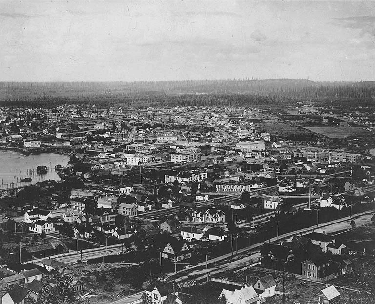
Bellingham in 1905.
Coal mining occurred in the Bellingham area from the mid 19th–mid 20th centuries. Coal was originally discovered by Henry Roeder off the northeastern shore of Bellingham Bay. In 1854, a group of San Francisco investors established Bellingham Bay Coal Company. The mine extended to hundreds of miles of tunnels as deep as 1200'. It ran southwest to Bellingham Bay, on both sides of Squalicum Creek, an area of about one square mile. It employed some 250 miners digging over 200,000 tons of coal annually, at its peak in the 1920s. It was closed in 1955.
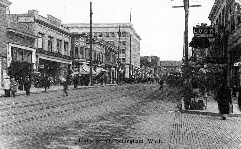
Holly Street, downtown Bellingham. 1918.
Bellingham was officially incorporated on November 4, 1903 as a result of the incremental consolidation of four towns initially situated around Bellingham Bay during the final decades of the 19th Century. Whatcom is today's "Old Town" area and was founded in 1852. Sehome was an area downtown founded in 1854. Bellingham was further south near Boulevard Park, founded in 1853; while Fairhaven was a large commercial district with its own harbor, also founded in 1853.
In 1890, Fairhaven developers bought Bellingham. Whatcom and Sehome had adjacent borders and both towns wanted to merge; thus they formed New Whatcom. Later on October 27, 1903, the word "New" was dropped from the name, making it into simply "Whatcom". At first, attempts to combine Fairhaven and Whatcom failed, and there was controversy over the name of the proposed new city. Whatcom citizens wouldn't support a city named "Fairhaven", and Fairhaven residents wouldn't support a city named "Whatcom". They eventually decided to use the name "Bellingham", which remains today. Voting a second time for a final merger of the four towns into a single city, the resolution passed by 2163 votes "for" and 596 "against". Only men were allowed to vote during that era before American women's suffrage.
In the early 1890s, three railroad lines arrived, connecting the bay cities to a nationwide market of builders. The foothills around Bellingham were clearcut after the 1906 San Francisco earthquake to help provide the lumber for the rebuilding of San Francisco. In time, lumber and shingle mills sprang up all over the county to accommodate the byproduct of their work. In 1889, Pierre Cornwall and an association of investors formed the Bellingham Bay Improvement Company (BBIC). The BBIC invested in several diverse enterprises such as shipping, coal, mining, railroad construction, real estate sales and utilities. Even though their dreams of turning Bellingham into a Pacific Northwest metropolis never came to fruition, the BBIC made an immense contribution to the economic development of Bellingham.
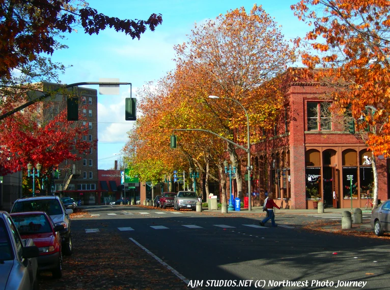
Bellingham's Holly Street downtown in the fall of 2009. AJM STUDIOS Northwest Photo Journey photo.
BBIC was not the only outside firm with an interest in Bellingham utilities. The General Electric Company of New York purchased Bellingham's Fairhaven Line and New Whatcom street rail line in 1897. In 1898 the utility merged into the Northern Railway and Improvement Company which prompted the Electric Corporation of Boston to purchase a large block of shares.
Bellingham's proximity to the Strait of Juan de Fuca and to the Inside Passage to Alaska helped keep some cannery operations here. P.A.F., for example, shipped empty cans to Alaska, where they were packed with fish and shipped back for storage.
Climate
Bellingham's climate is generally mild, often referred to as "The Banana Belt of the NorthWest." The average yearly high and low temperatures are 57 and 41 degrees Fahrenheit (14 and 5 °C), respectively. Although the rainy season can last as long as eight months or more, it is usually about six months long, leaving Bellingham with a picturesque late spring and mild, pleasant summer. Although Bellingham receives an average annual rainfall of 34.8 inches (880 mm), many long weeks of short and cloudy days are commonplace in winter.
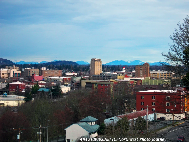
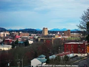
Bellingham's skyline on a typical cloudy day.
Western Whatcom County has a damp marine climate. Successful local farmers plan for the possibility of substantial rain every day of the year and take advantage of the dry days when they occur. It may not rain every day, but it is never a good assumption that it will not rain somewhere in Whatcom County on any given day. Summers are relatively dry. By way of comparison, Phoenix, Ariz. receives more rainfall in July, on average (0.99 inches), than Bellingham (0.90 inches). For July and August combined, Bellingham sees an average of 5.7 rainy days, compared with 10 days for Phoenix. Drought is almost unknown, however, although some summers are considerably drier than others and some normally reliable wells have been known to run dry in August and September. Nevertheless, crops are more frequently ruined by too much rain than too little.
Bellingham's location and geography occasionally subject it to an unusual and harsh weather pattern known locally as a "Nor'Easter," (pronounced "Northeaster" by old-timers.) Effectively, an upper level trough can drive down cold Arctic air from the Canadian interior, usually through the Fraser River Canyon. This cold air mass can collide with a Gulf of Alaska cold front and create high winds, ice, snow, or heavy rains.
Another weather phenomenon, known as the "Chinook wind," happens in the autumn. For most of a day, an unusually warm and steady wind comes out of the south. It is essentially a reverse "Nor'Easter." A Chinook wind following a northeast wind can melt eight foot snow drifts overnight, pushing drainage systems to their limits.
The hottest official temperature is 96 °F (36 °C), set on July 29, 2009, beating the old record of 94 °F (34 °C) by 2°F.
Geography
The city has a total area of 31.7 square miles (82 km2), of which 25.6 square miles (66 km2) is land and 6.1 square miles (16 km2) (19.2%) is water. The lowest elevations are at sea level along the waterfront. Alabama Hill is one of the higher points in the city at about 500 feet. Elevations of 800 feet are found near Yew Street Hill north of Lake Padden and near Galbraith Mountain. Beyond the city limits of Bellingham many taller foothills and small mountains rise in Whatcom County, until climbing to a peak elevation of 10,778 feet at the summit of Mount Baker which is just over 31 miles from the seashore. Mount Baker is the largest volcano in the local area, and its glaciers are visible from many parts of the city. Lake Whatcom forms part of the eastern boundary of the city, while many smaller lakes and wetland areas are found around the region. Bellingham is also about 50 miles south of Vancouver.
Surrounding Municipalities
To the northwest is the Ferndale. Laurel is to the north, and Deming to the northeast. Lummi Island is to the direct west while Acme is to the east. South of Bellingham is Bow in Skagit County.
Districts and their Neighborhoods

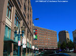
Bellingham's Central Business District downtown. AJM STUDIOS Northwest Photo Journey photo.
- Alabama (Northeast area of city)
- Birchwood (Northwest area of city)
- Central Business District (Downtown Bellingham)
- Cornwall (Cornwall Park area)
- Columbia (North of downtown)
- Edgemoor (Southeast area of the city)
- Fairhaven (On the South side of the city)
- Guide Meridian/Cordata (North side of the city)
- Happy Valley (Happy Valley area)
- Lettered Streets (North of downtown and east of Columbia Neigh.)
- Meridian (North of Cornwall Park)
- Mount Baker (East of Cornwall Park)
- Puget (Puget / Lakeway Area)
- Roosevelt (East of I-5 and north of Whatcom Creek)
- Samish (Samish Dr Area)
- Sehome (Sehome Hill / Holly / Samish way area.)
- Silver Beach (Silver Beach area)
- South (Area south end of Bellingham city district.)
- South Hill (South Hill / Highland drive to the water)
- Sunnyland (East of downtown.)
- Whatcom Falls (Lakeway/Yew/Electric area)
- WWU (Western Washington University)
- York (York street Area)
Culture
Bellingham has many local events and attractions. The music scene, and independent filming is very big in Bellingham.
Landmarks

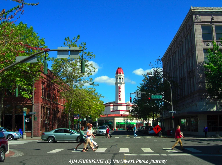
Mount Baker Building in downtown Bellingham. AJM STUDIOS Northwest Photo Journey photo.
Bellingham has a historical downtown full of historic buildings and landmarks. Some landmarks include the historic old City Hall in downtown, and the Bellingham Towers, which is the tallest building in the city. The Mount Baker Building is a landmark to the city as well.
Media
Television
KVOS (KVOS 12)
KBCB (NBC 24)
BTV10 (Bellingham TV Channel 10)

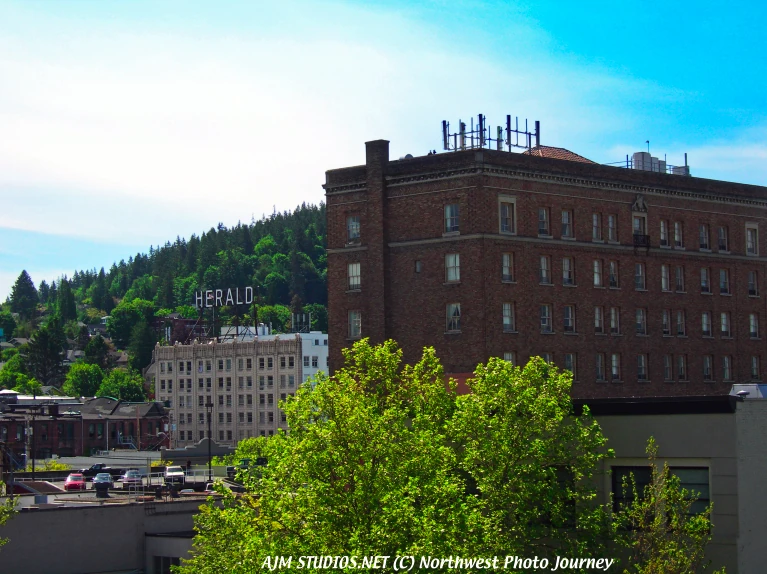
The Bellingham Herald Building in downtown. AJM STUDIOS Northwest Photo Journey photo.
Newspapers
The Bellingham Herald
The Bellingham Business Journal
The Cascadia Weekly
The Western Front
The AS Review
Whatcom Watch
Sports
Baseball: WCL: Bellingham Bells
Basketball: IBL: Bellingham Slam
Football: EFL: Bellingham Bulldogs
Rugby: PNRFU: Chuckanut Bay Geoducks
Infrastructure
Health systems
Saint Joseph's Hospital serves Bellingham and Whatcom County.
Crime
The Whatcom County Sheriff's main office is located in Bellingham. Bellingham is serviced by the Whatcom County Sheriff's Office and the Bellingham Police Department.
Transportation
The Bellingham International Airport offers regularly scheduled commuter flights to and from Seattle and Friday Harbor, Washington, and regularly scheduled jet service to Las Vegas, Nevada; Reno, Nevada; San Francisco; Mesa, Arizona and seasonal service to Palm Springs, California. The airport is home of the first Air and Marine Operations Center, to assist the US Department of Homeland Security with border surveillance.
Amtrak Cascades provides Bellingham with regularly scheduled passenger rail service to Seattle and Vancouver, British Columbia, Canada. Whatcom Transportation Authority offers regular scheduled bus service throughout the Bellingham area, including service to Mount Vernon.