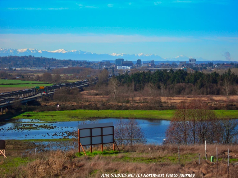
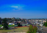
Everett skyline, Olympic Mountains in backdrop. AJM STUDIOS Northwest Photo Journey photo.
Everett is the county seat of and the largest city in Snohomish County, Washington. Named for Everett Colby, son of founder Charles L. Colby, it lies 25 miles north of Seattle. The city had a total population of 91,488 at the 2000 census, making it the 6th largest in the state and fourth-largest in the Puget Sound area. Since the census, the city has continued to grow, reaching an estimated population of 103,500 in 2009. As of 2017, the population was 109,800. It received an All-America City Award in 2002. Everett is home to the largest public marina on the west coast of the United States and is the western terminus of the western segment of U.S. Route 2. It is also home to Boeing's assembly plant for the 747, 767, 777, and the new 787 in the largest building in the world by volume at 116.5 million cubic feet.
History
Captain George Vancouver landed on the peninsula that now contains the city of Everett in 1792. He claimed all the surrounding area for King George III of England. Captain Vancouver named the nearby bay Port Gardner Bay and the adjoining peninsula Port Gardner Peninsula. The earliest settler to claim land on the Port Gardner Peninsula was Dennis Brigham. He built a cabin overlooking the bay in 1862. E. D. Kroner, a telegraph operator, settled on land near Brigham in a cabin that was an office and telegraph station as well as a home. For many years only a few settlers came to live in the area.
In 1890 things began to change. The Rucker brothers from Tacoma same to the peninsula and bought Brigham's farm. They believed the railroads would come to the peninsula and it would be a good place to build a town. They wanted to call the new town Port Gardner City.
About the same time Henry Hewitt of Tacoma was looking for areas for logging. He came to Port Gardner Peninsula and was impressed by the deep bay and nearby river. He spoke to some rich friends and wanted them to help build a city on the peninsula. Charles Colby of New York, Alexander McDougall who built boats, and Warren Oakes of the Northern Pacific Railroad agreed to become partners in the Everett Land Company and build a city. The city was named for Charles Colby's son, Everett. The Everett Land Company bought much of the Rucker brothers' land.
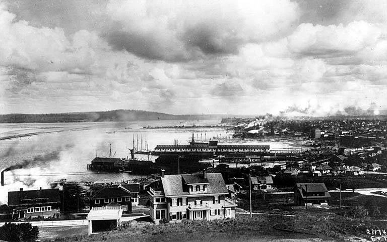
Everett's industrial waterfront from Rucker Hill in 1914.
Early Everett was a factory town. A pulp and paper mill was built. A factory to build steel barges and another factory to make nails and wire were opened. A smelter was built to refine gold and silver from the Monte Cristo mines in the Cascade Mountains. The town was called the "Magic City" because it grew so quickly.
Workers for the new town of Everett came from Seattle, Tacoma and nearby areas. People from the Mid-western United States traveled to help build and settle in Everett. Some workers came from foreign countries such as Canada, Norway, Sweden, England and Germany.
The men of the Everett Land Company hoped the railroad would come to town and make Everett an important town for shipping goods across the United States. By 1893 they were told the main railroad on Puget Sound was coming to Seattle, not Everett. Meanwhile, Mr. Hewitt's rich Eastern friends began to lose money in the Eastern part of the United States and they stopped investing their money in Everett businesses. Factories closed and many people left town.
During the next few years Everett's growth was slow. Fisheries, canneries and some shipbuilding were located along the waterfront. In 1900 Frederick Weyerhauser built a new sawmill in Everett. The Weyerhauser Timber Company and other logging operations became the main industry of the town for many years to come.
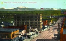
Everett's downtown in a early twentieth century post card, which was artificially colored.
Everett also was the site of the Everett Massacre of 1916 which was an armed confrontation between a mob led by local Sheriff Donald McRae and IWW members. The IWW members were on the steamer Verona and sought to land, but Sheriff McRae denied them his permission. Shooting broke out and at least five IWW's were killed and two in the Sheriff's mob were killed, though they might have been accidentally shot by others in their allegedly drunken group.
In 1984, Everett was selected as the site of a U.S. Navy Homeport, Naval Station Everett. The Naval Station formally opened in 1992 and on January 8, 1997 welcomed the aircraft carrier USS Abraham Lincoln. Everett is also home to the Port of Everett, an international shipping port, that brings trade, commerce, jobs and recreational opportunities to the city.
Everett streets are named after each of the three founders. Adjacent streets Colby Avenue and Hoyt Avenue run north and south and are intersected by Hewitt Avenue running east and west just south of the BNSF Railway tracks cutting across Everett. There are several other streets named for their associates such as Bond Street named for Judge Hiram Bond, President of the Everett & Monte Cristo Railroad. Parallel to Colby and Hoyt are avenues named for other investors, John D. Rockefeller, railroad executive T.F. Oakes, shipbuilder Alexander McDougall, and McDougall's associate Charles W. Wetmore.
Geography
The core of Everett sits on the Port Gardner Peninsula, formed by Port Gardner Bay on the west and the Snohomish River to the north and east. Newer portions of the city generally extend southward from this point for a distance of approximately 8 miles.
According to the United States Census Bureau the city has a total area of 47.7 square miles.
Surrounding Municipalities
Port Gardner Bay is located to the northwest of Everett while Possession Sound, a part of the Puget Sound, is to the west of downtown Everett. Jetty Island is off the western shoreline of the city while Hat Island is northwest of city limits as is Whidbey Island.
Marysville is to the north and northeast. Lake Stevens is east of Everett. Mukilteo is to the west, and Snohomish and Fobes Hill are to the east. Mill Creek, Martha Lake, and Lynnwood are south.
Climate
The climate of Everett is heavily influenced by marine air masses which tend to moderate temperatures with seasonal variations much less pronounced than inland areas.
During the summer temperatures tend to be in the 60's to low 70's and cold during winter when temperatures tend to be in the 40's.
The warmest month of the year is August with an average maximum temperature of 73.90 degrees Fahrenheit, while the coldest month of the year is January with an average minimum temperature of 33.60 degrees Fahrenheit. In July the average temperature is 73 Fahrenheit while in January it is 46 Fahrenheit.
Temperature variations between night and day tend to be fairly limited during summer with a difference that can reach 19 degrees Fahrenheit, and fairly limited during winter with an average difference of 13 degrees Fahrenheit.
The annual average precipitation at Everett is 37.54 Inches. Rainfall in is fairly evenly distributed throughout the year. The wettest month of the year is November with an average rainfall of 5.11 Inches. The driest month is usually July.
City Layout
Districts and their Neighborhoods
Broadway leading into downtown Everett.
The city of Everett maintains an Office of Neighborhoods which facilitate communication between the city and the 19 established neighborhood associations, with one proposed neighborhood/mixed-use development. Each of the officially recognized neighborhood associations operate independently to better their established geographic areas within the city. The neighborhoods are:
- Bayside - comprising much of the central business district, the waterfront, and the surrounding residential areas.
- Boulevard Bluffs - primarily residential area of the city bordering Mukilteo.
- Cascade View - residential area in South Everett, north of Everett Mall
- Delta - primarily residential area north of downtown Everett
- Eastmont - the area overlooking the valley
- Everett Mall South - the area surrounding Everett Mall, a mix of residential and commercial areas.
- Evergreen - primarily residential area in South Everett.
- Glacier View - older residential area south of downtown.
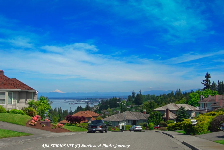
Everett seen from the Harborview neighborhood.
* Harborview-Seahurst-Glenhaven - older residential areas south of downtown.
- Holly - a mix of residential, commercial, and industrial areas on the southern edge of the city.
- Lowell - formerly an independent town, Lowell is a primarily residential area southeast of downtown.
- Northwest - older residential areas northwest of downtown.
- Pinehurst-Beverly Park - mix of residential and commercial developments in South Everett.
- Port Gardner - residential neighborhoods south of downtown.
- Riverside - areas just northeast of downtown.
- Seaway Park - Industrial complex with residential developments located near the Boeing Plant.
- Silver Lake - residential and commercial areas surrounding Silver Lake in the extreme southeastern part of the city.
- South Forest Park - residential neighborhood near downtown.
- Valley View-Sylvan Crest-Larimer Ridge - residential areas in southeast Everett.
- View Ridge-Madison - residential areas near downtown, or central part of Everett.
- Westmont - primarily multi-family housing in the southwestern part of the city.
Culture
Around Town
The Historic District
The Everett historic district runs from around 8th Street to 25th Street, north to south and from Broadway to Grand Avenue, east to west. The district contains many old stately homes including the home of the former U.S. Senator Henry M. Jackson on Grand Avenue.
The Waterfront
Situated at the mouth of the Snohomish River on Possession Sound, the Everett waterfront is home to Naval Station Everett, a sprawling Kimberly-Clark paper mill and the Port of Everett (est. 1918). The Port of Everett includes both a deep-water commercial seaport and a marina with over 2000 slips, which it claims to be the largest on the west coast of the United States. Ambitious redevelopment began in 2006 to convert the north end of the waterfront into a community of maritime business, retail shops and condominiums, beginning with the Port of Everett's Port Gardner Wharf. In 2006, the seaport received 119 ships and 59 barges, totaling some 192,000 short tons of cargo. The waterfront is also home to the Everett Yacht Club, which was founded in 1907, although it existed in some form as early as 1895. During summer months, the marina is home to the Everett Farmer's Market (Sundays) and the Waterfront Concert Series (Thursday nights), part of a city-wide free concert series which in 2006 attracted over 26,000 visitors. Each September, Tenth Street Park on the waterfront is home to the annual Everett Coho Derby, while each August the marina promenade is gowned in local art during the Fresh Paint Festival of Artists.
Parks
Everett is home to 40 parks. The biggest parks are Walter E. Hall Park at 137 acres (0.6 km2), Forest Park at 111 acres, Langus Riverfront Park at 96 acres, Kasch Park at 60 acres, Howarth Park at 28 acres, and Thornton A. Sullivan Park at 27 acres. Walter E. Hall Park near the Boeing plant sports a golf course and a skate park, Forest Park a swimming pool, hockey, horseshoes, miles of trails and an animal farm, Langus Park a boat launch, Kasch Park four softball fields, Howarth Park a sandy beach on Puget Sound, and Thornton A. Sullivan Park hosts a sandy swimming beach on Silver Lake as well as public docks for fishing. Harborview Park has a stunning view of Everett's waterfront, and Port Gardner, as well and ample green space.
Forest Park
Forest Park is the oldest public park in Everett. Its address is 802 E. Mukilteo Boulevard. The park is 111 acres (0.4 km2) and is home to miles of trails, a playground, and a pool. The pool is the crowning jewel of the park, complete with lifeguards. Hundreds of children take swimming lessons at the pool every year, making the pool an extremely valuable part of the parks system.

Everett's waterfront from Jetty Island.
Jetty Island
Along the waterfront lies the Port of Everett owned Jetty Island, a narrow, 2-mile long man-made island, featuring large sandy beaches and relatively warm water. Jetty Island is the result of a failed attempt in the early 1900s by the U.S. Army Corps of Engineers to create a freshwater harbor west of downtown Everett. The island is now a day-use park with no running water, electricity, or overnight facilities. The City of Everett Parks and Recreation Department celebrates Jetty Island Days during the summer, and provides free ferry service to the island from the 10th Street Boat Launch from June through the Labor Day holiday weekend. The wide flat beaches and strong winds make the island a popular kite-surfing destination as well as a popular spot for avid skimboarders.
Nishiyama Garden
Nishiyama Garden is a traditional Japanese garden located at the Nippon Business Institute at Everett Community College. It features Sukiya style wooden gates, gravel paths, stones, trees, a small stream and a portion of a famous Kintai Bridge from Iwakuni, Japan, one of Everett's sister cities
Evergreen Arboretum and Gardens
Evergreen Arboretum and Gardens (2.4 acres) is an arboretum and park located at the south end of Legion Park, at the intersection of Alverson and Marine View Drive.
Media
Television
KONG-TV (Broadcasts from Seattle, licensed to Everett. King 5 News)
Newspapers
Everett Herald
Little Nickel
Snohomish County Business Journal
Sports
Baseball: NWL: Everett AquaSox
Hockey: WHL: Everett Silvertips
Basketball: ABA: Everett Longshoremen
Lacrosse: NLL: Washington Stealth
Healthcare
Everett General Hospital was founded in 1894 and 100 years later on March 1, 1994 was merged with Providence Hospital (est. 1905) to form Providence Everett Medical Center. In 2005 it was named one of America's 100 top hospitals for the third time in thirteen years.
Providence Everett Medical Center
Children's Hospital & Regional Medical Center
The Everett Clinic was established in 1924 by four Everett physicians and has evolved into a regional health-care provider with sixteen locations throughout Snohomish County. It serves more than 2,300 patients each day.
Public Safety
The Snohomish County Sheriff's main office is located in Everett. Everett is serviced by the Snohomish County Sheriff's Office and the Everett Police Department.
In 2009, Everett has been ranked with the 90th highest crime rate in the United States (of 393 communities ranked).
In 2008, Everett had 1,183 car thefts. The city also had 76 rapes, or 78.7 rapes per 100,000 people, twice the national average rate of 32.2 rapes per 100,000 people.
There was only one murder in 2008, leaving the city with a murder rate well below the national average for that year.
Transportation
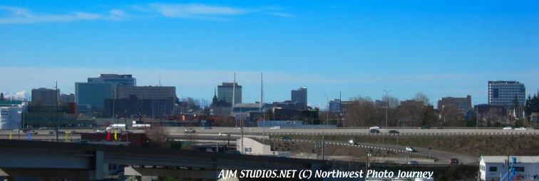

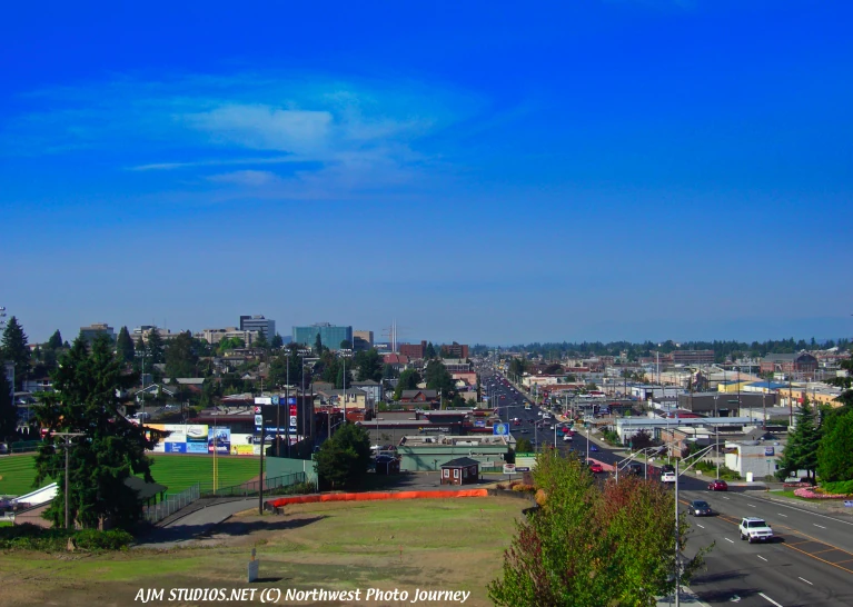
Everett skyline, 2010. Freeways and highways entering and leaving the city. AJM STUDIOS Northwest Photo Journey photo.
Public transit service has operated in Everett since 1893. From 1910-1939 Everett was connected with Seattle by the Seattle-Everett Interurban Railway. Today Everett Transit (est. 1969) provides bus service throughout the city, operating 46 buses and 18 ParaTransit vehicles with daily ridership of 6,800. Sound Transit provides commuter train and bus service to Seattle and bus service to Bellevue. Community Transit connects Everett with the remainder of Snohomish County.
The closest international airports are Boeing Field and Seattle-Tacoma International Airport, and Snohomish County operates Paine Field (PAE) for private aviation. Everett Station is served by Amtrak, code name EVR, and two trains, the Empire Builder and the Amtrak Cascades stop there.