Mukilteo (/ˌmʌkəlˈtiːoʊ/ US dict: mŭk′·əl·tē′·ō), which means "good camping ground," is a waterfront city in Snohomish County, Washington. The population was 20,254 at the 2010 census and 21,486 as of 2020. It is on the shore of the Puget Sound, and is the site of a Washington State Ferries terminal linking it to Clinton, on Whidbey Island. The city was incorporated on May 8, 1947.
Mukilteo is one of the most affluent suburbs of Seattle and Everett. In 2007, the city had a median income of $83,569. Additionally, like the rest of the Seattle area, house prices have risen rapidly; the median value in 2007 was $567,000. Based on per capita income, Mukilteo ranks 29th of 522 areas in the state of Washington. The city is also home to one of the most expensive high schools ever built in America, Kamiak High School. In 2009, Mukilteo was ranked as number 10 of Money Magazine's top 100 small towns of America to live in. In 2011, Mukilteo rose one rank to number 9.
History[]
Though the word Mukilteo is widely believed to mean "good camping site," some note that in the Snohomish dialect Muk-wil-teo means "narrow passage," a reference to the sand spit that formed the original Mukilteo landing. Mukilteo was officially incorporated on May 8, 1947, but the city has a historic role in the development of the Puget Sound. It was at Mukilteo that the Point Elliott Treaty was signed between Governor Isaac Stevens and the chiefs of 22 Puget Sound tribes on January 22, 1855.
The treaty ceded land to the United States from Point Pully (now called Three Tree Point south of Seattle) to the British (Canadian) border in exchange for a variety of benefits, including land, education, health care and hunting and fishing rights. The treaty was signed before more than 2,500 Native Americans.
According to the Mukilteo Historical Society, the town became the first settled by Europeans in 1858 and was the county seat of Snohomish County from 1861 when Snohomish County was created from Island County to 1867, when the city of Snohomish became the county seat. Initially the settlement was called Point Elliott, the name given the location by the Wilkes Expedition in 1841.
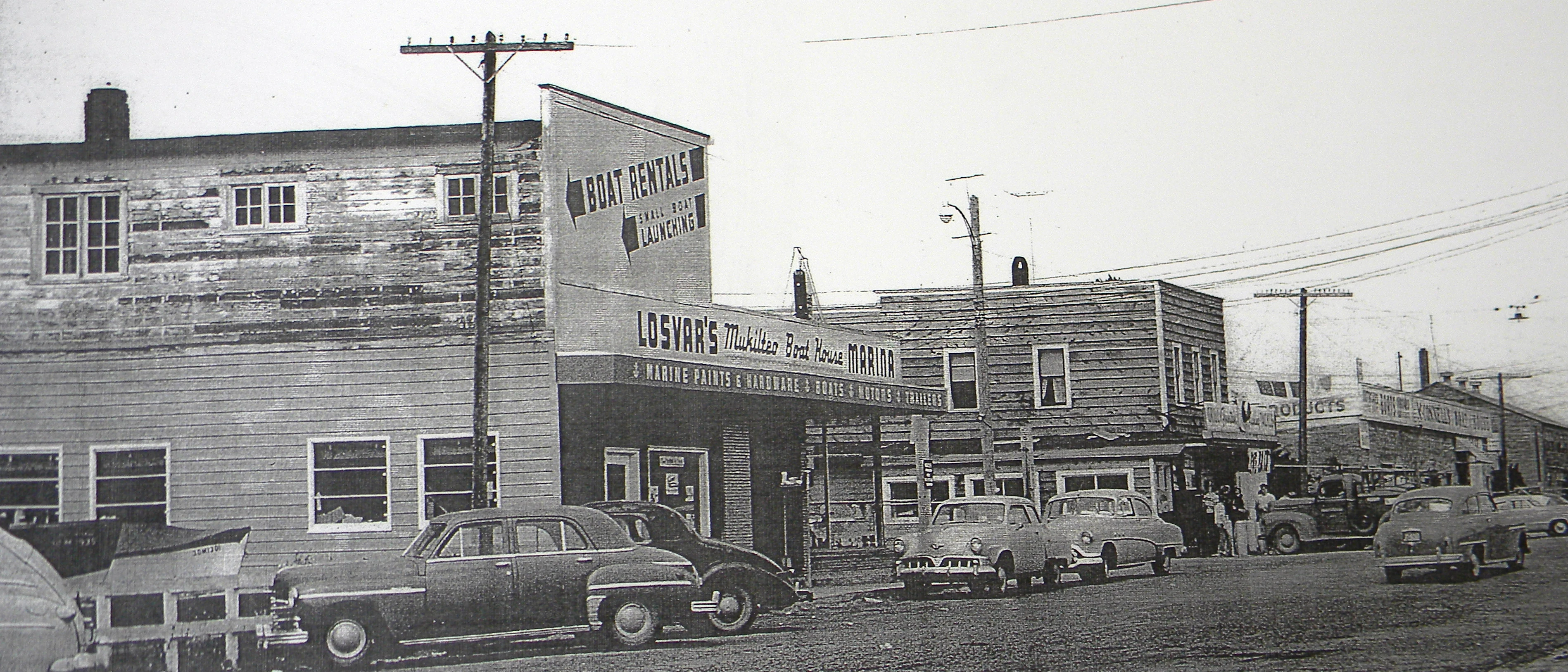
Downtown Mukilteo in the 1940s.
In its early years, Mukilteo was a fishing village, trading post, and a port-of-entry. Surrounding wooded hills filled with Douglas fir, cedar and hemlock supported a lumber mill and the town also had a cannery, a brewery, and a gunpowder plant. Traces of the powder mill remain in the name of Powder Mill Gulch, a ravine that is located about one mile into the city limits of Everett. Japanese Gulch provides rail access from the Mukilteo waterfront to the Boeing's Boeing Everett Factory at Paine Field.
In 1900, the population was only 350. The next year, the federal Lighthouse Board decided to put a light and fog signal at the point in Mukilteo. The lighthouse, which still stands today, was completed in 1906.
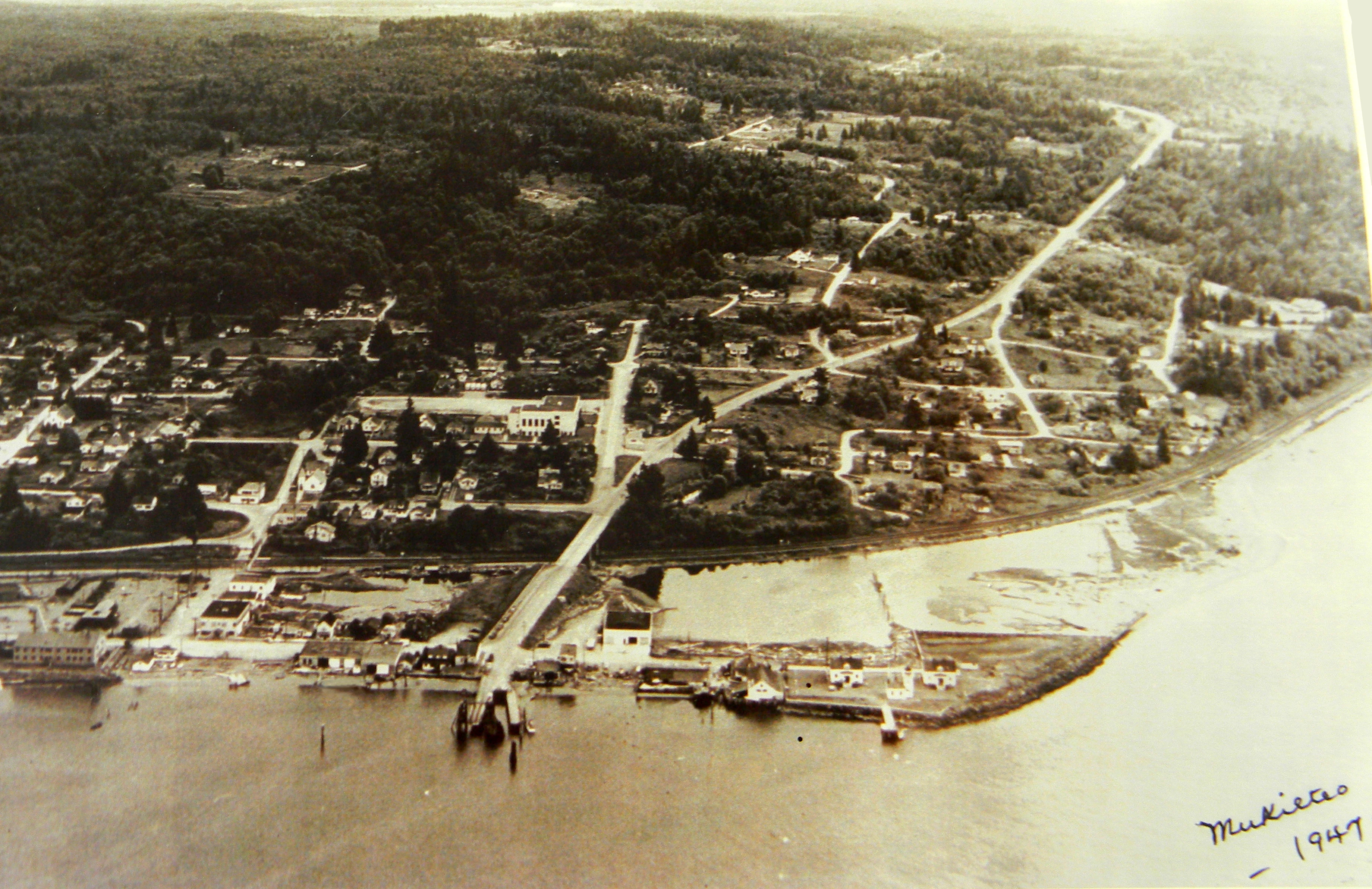
Aerial of Mukilteo. 1947.
Even at incorporation in 1947, almost a century after the Point Elliott Treaty, Mukilteo's population stood at only 775. But by 1947, there was ferry service to Whidbey Island, a fuel storage facility for the Air Force on the waterfront, and a major rail line for the Great Northern Railway along the city's entire waterfront.
The first growth spurt for the city came with the 1980 annexation of an additional 1.2 square miles to the south along the Mukilteo Speedway or SR 525, which increased the population to 4,130 people. In 1991, the Harbour Pointe area was annexed, doubling the size of the city to 6.25 square miles. The annexation increased the city's population to just over 10,000 and also presaged a shift from the Old Town commercial center near the ferry to new shopping and banking facilities at Harbour Pointe. The city has agreed to an urban growth area that includes approximately 15,000 additional potential residents in 2005.
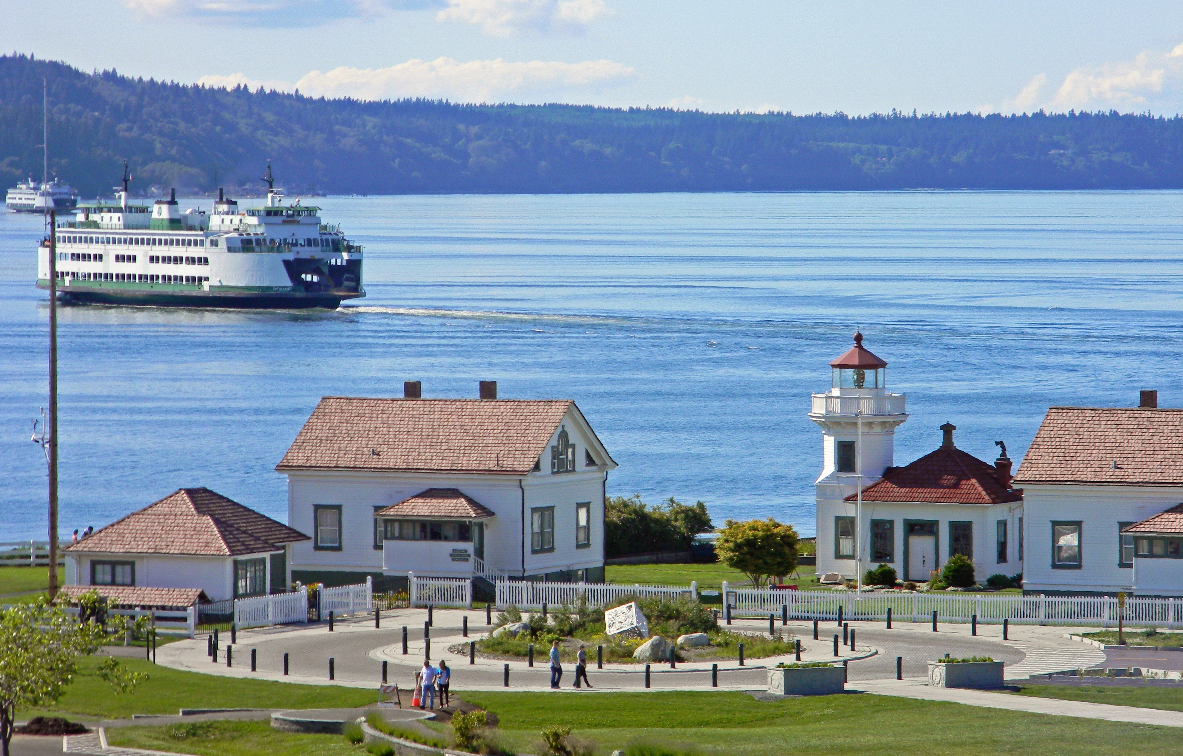
The major parkland in the city is the former state park and lighthouse, next to the ferry docks. In 1954, the state acquired 17 acres of land around the lighthouse and made it into a state park, including a popular boat ramp. In 2003, the state faced a budgetary crisis and offered to cede the park to the city, which the city accepted. The city renamed the park Mukilteo Lighthouse Park and has plans for redevelopment that may ultimately spend $6 million for new facilities.
Substantial development is expected along the waterfront in the next five to ten years, with the state planning to build a new ferry terminal east of the current location. The Mukilteo-Clinton ferry provides service for 3 million passengers per year with two ferries currently serving the run.
In 1992, the government of Mukilteo opposed plans to expand Paine Field; Mayor Brian Sullivan said that the city disagrees "with the idea of a Sea-Tac north" and supports upholding a 1978 agreement between residents around Paine Field and Snohomish County.
The transportation hub will use some of the land being turned over by the federal government on the site of the old fuel docks. Included is an $18 million terminal for Sounder commuter rail service, scheduled to open in June, 2008 on the Everett-Seattle line. In addition, the city and Port of Everett are working to redevelop the remaining land on the tank farm property for private and public use.
Mukilteo's waterfront.

Mukilteo Lighthouse Park.
Geography[]
According to the United States Census Bureau, the city has a total area of 9.50 square miles, of which, 6.40 square miles is land and 3.10 square miles is water.
Mukilteo is located at 47°54′58″N 122°18′11″W (47.916148, -122.302939).
The city is traversed by the Southern Whidbey Island fault zone, discovered in 1996.
To the north of Mukilteo is Possession Sound, part of the Puget Sound. Hat Island is also north. West is Whidbey Island and the ferry terminal community of Clinton is northwest. East of Mukilteo is the larger city of Everett. South is Picnic Point and Lynnwood.
Climate[]
The climate is mild during summer when temperatures tend to be in the 60's and cold during winter when temperatures tend to be in the 40's.
The warmest month of the year is August with an average maximum temperature of 73.90 degrees Fahrenheit, while the coldest month of the year is January with an average minimum temperature of 33.60 degrees Fahrenheit.

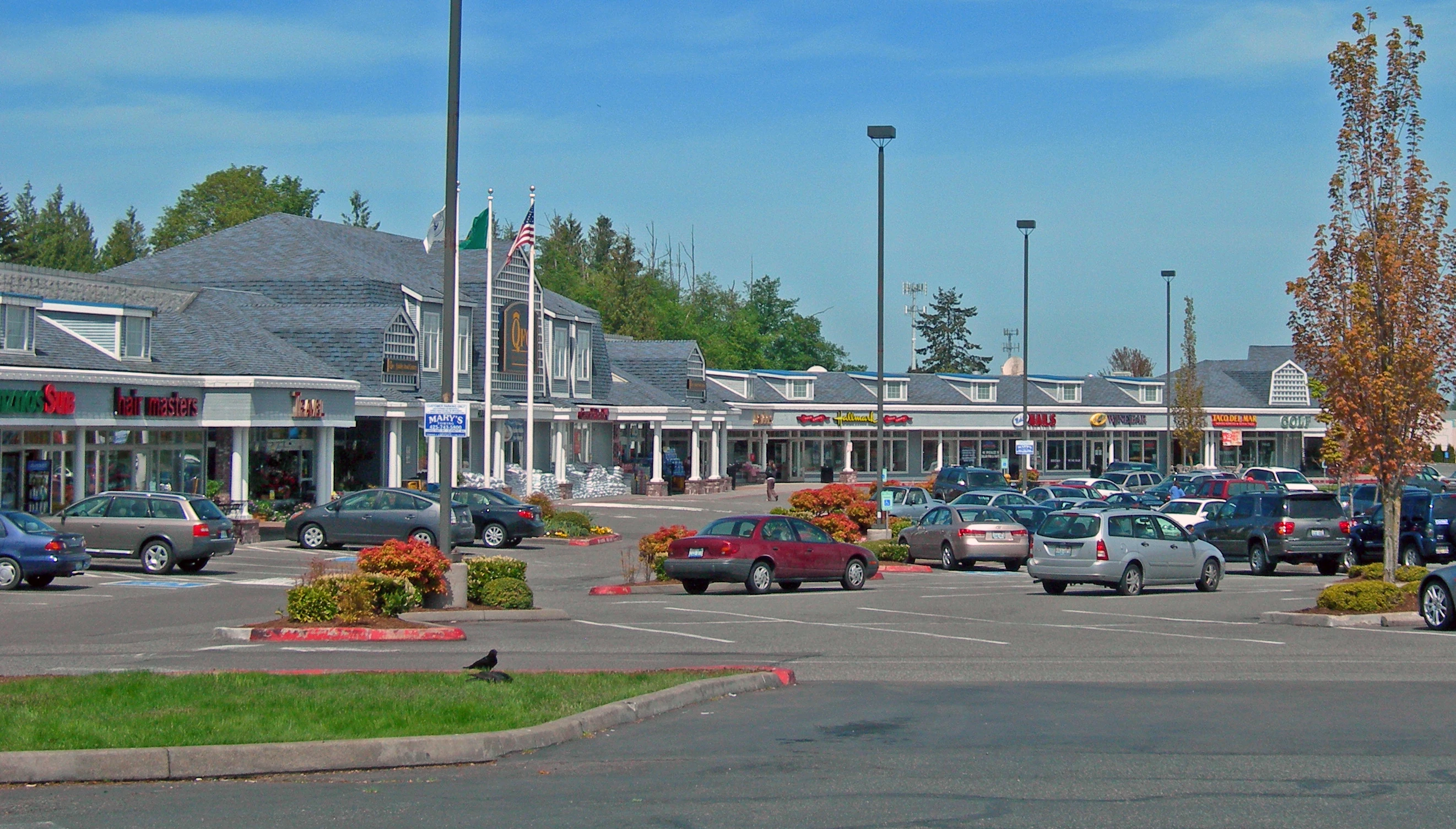
Business along Mukilteo Boulevard in the city's south end.
Temperature variations between night and day tend to be fairly limited during summer with a difference that can reach 19 degrees Fahrenheit, and fairly limited during winter with an average difference of 13 degrees Fahrenheit.
The annual average precipitation at Mukilteo is 37.54 Inches. Rainfall in is fairly evenly distributed throughout the year. The wettest month of the year is November with an average rainfall of 5.11 Inches.

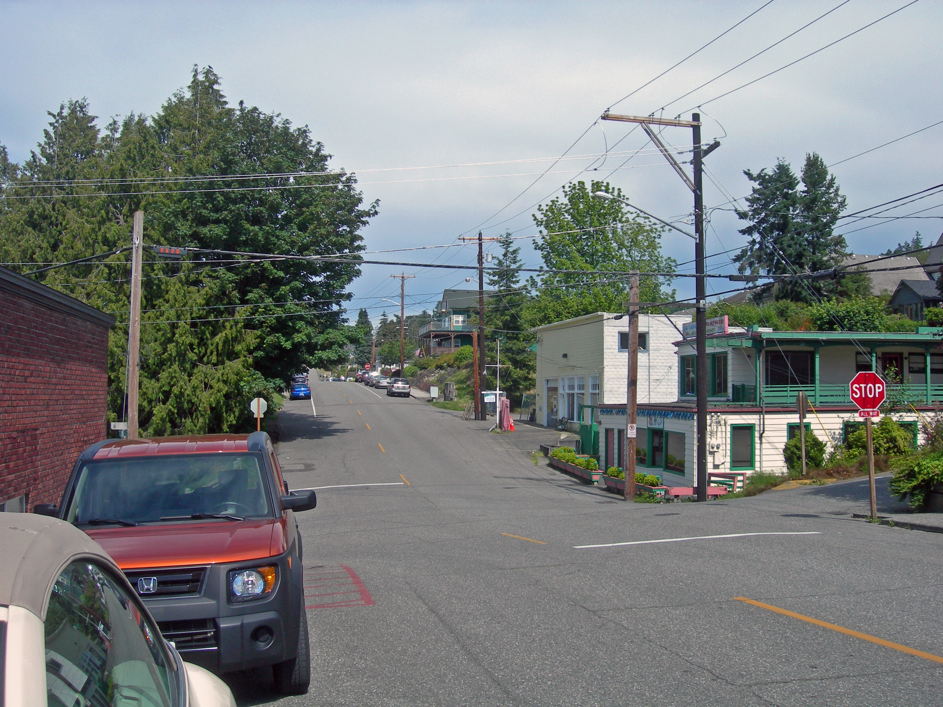
Part of Mukilteo's old business district.
Media[]
Newspapers[]
Mukilteo Beacon
Everett Herald
Trivia[]
In 2017, Mukilteo voters passed Proposition 1, which raised the sales tax to 10.4 percent. It became the highest sales tax in the entire country when it went into effect in 2018.